Langenweißbach
Aus Boulderwiki
Version vom 8. April 2020, 14:05 Uhr von Bastio (Diskussion | Beiträge)
Inhaltsverzeichnis |
Allgemeines
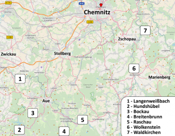
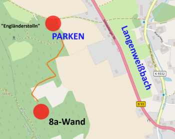
Anfahrt/Parken
Parkplatz GPS: 50°37'15.2"N 12°34'24.0"E - GoogleMaps: https://goo.gl/maps/G4r6s71zDJuBVpEu8
Vom Parkplatz durch den Wald Wegen und Pfaden folgen. Bitte respektiert die Anwohner und verhaltet euch zurückhaltend.
Die Blöcke liegen ca: 50°37'00.2"N 12°34'17.3"E - GoogleMaps: https://goo.gl/maps/TPPNVveL4v3Uitc16
Zustieg
Blöcke
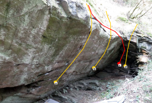
Block "8A-Wand"
| Nr. | Name | s.d. | Erstbegeher | Kommentar | |
|---|---|---|---|---|---|
| a | Erzbloc 2.0 | 7C | V.Bauch 2020 | ||
| b | Projekt | Projekt | |||
| c | Schicht im Schacht | 7a+ | V.Bauch 2019 | ||
| d | Willkommen im Schacht | 6a | V.Bauch 2019 |
| 8A-Wand |
|---|

|

